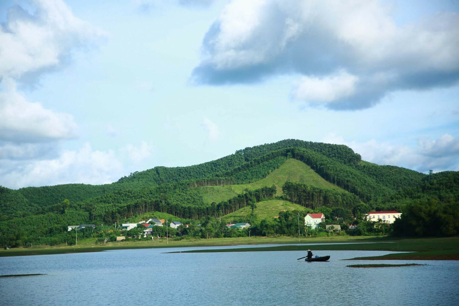
The Thanh Hoa map is an essential tool for guiding you through scenic landscapes, historical landmarks, and cultural experiences. With the Thanh Hoa Vietnam map in hand, you can easily navigate and explore the diverse attractions this province has to offer.
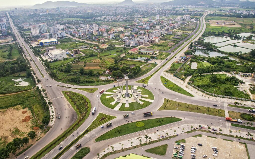
With the Thanh Hoa map, you can navigate the enchanting Thanh Hoa Province effortlessly. In this guide, we will unveil all aspects of Thanh Hoa, from its location and weather to its beautiful beaches, historical sites, and delightful specialties, promising an immersive journey through this captivating Vietnamese province.
1. Where is Thanh Hoa in Vietnam?
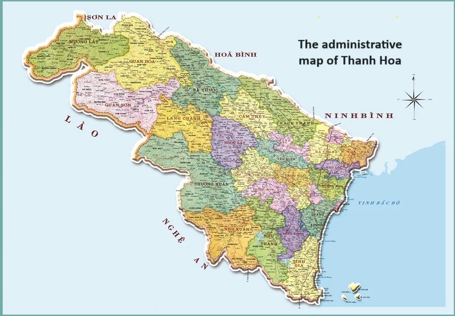
Thanh Hoa Vietnam is located in the north of the Central region, 150 kilometers south of Hanoi and 1,560 kilometers north of Ho Chi Minh City. On the Thanh Hoa map, it borders three provinces to the north: Son La, Hoa Binh, and Ninh Binh. To the south, it shares a border with Nghe An Province. To the West, it borders Houaphanh Province of Laos, and to the East lies the Gulf of Tonkin.
Regarding the climate, Thanh Hoa experiences a tropical monsoon climate with four distinct seasons characterized by abundant rainfall, high temperatures, and abundant sunlight. The average annual rainfall ranges from 1,600 to 2,300 millimeters, the relative humidity fluctuates between 85% and 87%, and the average temperature is around 23°C – 24°C.
In addition to its favorable geographical location, in recent years, Thanh Hoa’s tourism has flourished. This is thanks to its numerous scenic spots, historical sites, beautiful beaches, primeval forests, cave systems, and limestone mountains spread across its districts, along with various famous festivals. Some notable attractions include Sam Son Beach, Ben En National Park, Ho Citadel, and Ham Rong Mountain.
2. A glance through the districts on the Thanh Hoa map
Thanh Hoa Vietnam comprises 27 administrative units at the district level, including one city (Thanh Hoa), two towns (Bim Son and Sam Son), and 24 districts, making it the province with the highest number of administrative units in the country.
3. Best places to visit on the tourist map of Thanh Hoa
Looking at the Thanh Hoa map for tourists, you will see that Thanh Hoa Province offers numerous tourist attractions, catering to diverse preferences ranging from natural wonders to cultural landmarks.
3.1. Natural wonders
3.1.1. Beaches in Thanh Hoa
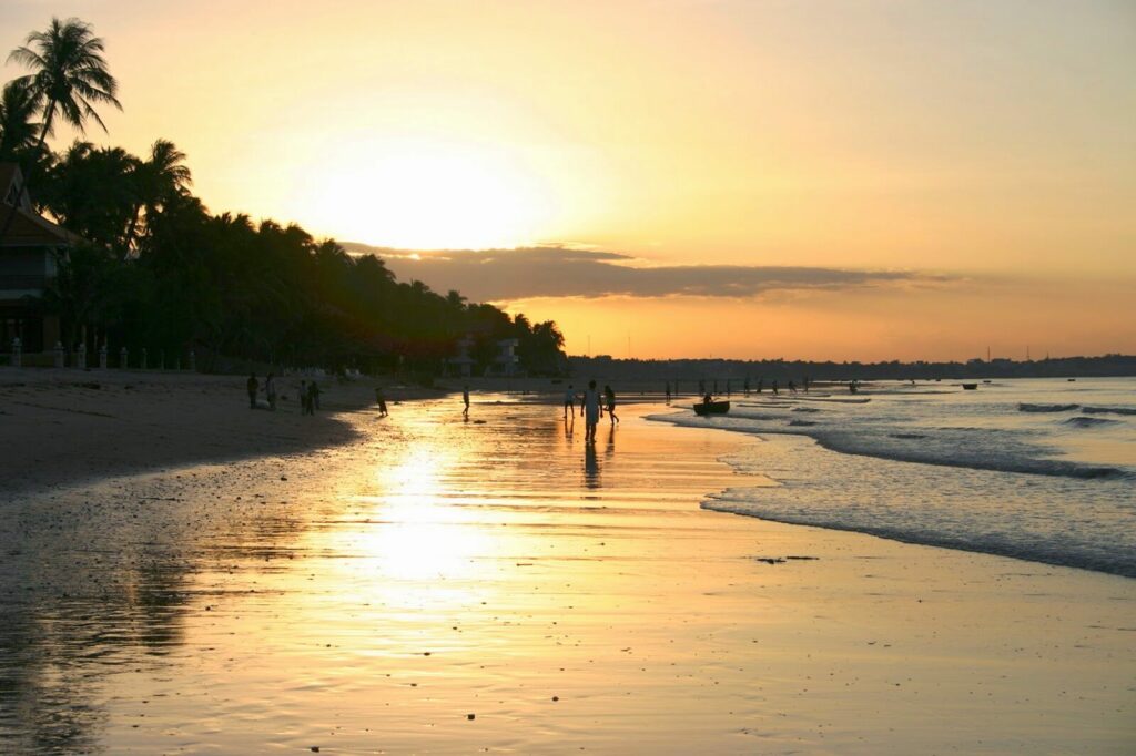
With a coastline stretching 100 kilometers, Thanh Hoa Vietnam boasts beautiful beaches. The most famous and crowded one is Sam Son Beach. It features strong waves and fine sand, which is suitable for beach activities like surfing. If you prefer a more tranquil atmosphere, you can visit Dong Beach, Hai Hoa Beach, and Hai Tien Beach with their calm water, which is ideal for relaxation.
3.1.2. Ben En National Park
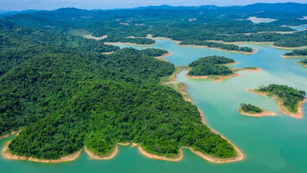
Ben En National Park covers a total area of 16,634 hectares on the Thanh Hoa map. Here, there are rivers, mountains, streams, and primeval forests, creating picturesque landscapes. It offers various activities such as boating, swimming, and camping. Ben En also boasts diverse ecosystems, featuring valuable medicinal plants and rare animal species such as the red-eyed monkey, allowing you to indulge in the wonders of nature.
3.1.3. Pu Luong Nature Reserve
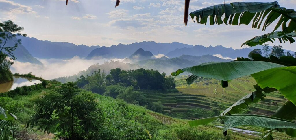
As an ecological preservation area situated at an altitude of 1,700 meters, Pu Luong Vietnam has a cool climate, fresh air, and landscapes close to nature. It has two rice harvesting seasons in May and October each year, attracting many tourists. Here, visitors can conquer Pu Luong Peak, visit Hieu Village and Hieu Stream – where tree roots inside the stream have turned into stone, Tom Village, Doi Cave, etc.
3.1.4. Cam Luong Fish Stream
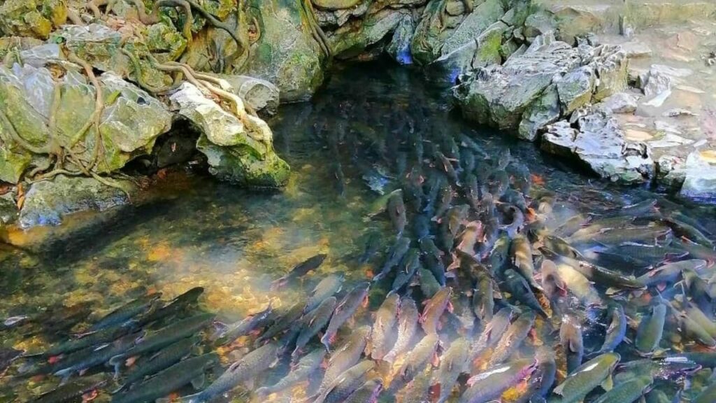
Cam Luong Fish Stream is an impressive natural attraction on the Thanh Hoa map. Originating from a limestone mountain, the stream is only about 150 meters long but is home to thousands of colored fish. It never runs dry and remains clear almost all the time. The best time to visit the stream is from April to September, when the water level is highest and you can see many swimming fish.
3.1.5. Kim Son Scenic Area
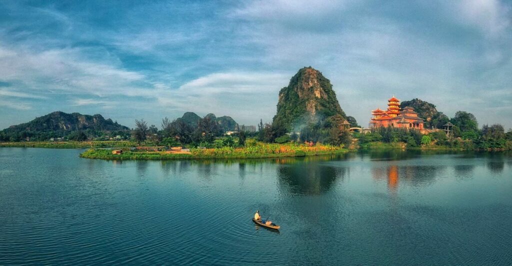
On the Thanh Hoa map for tourists, Kim Son Scenic Area attracts travelers with a range of mountains, caves, and lakes. Here, visitors can take a boat trip on Au Stream to explore places like Ngoc Ho Cave with unique stalactite formations, Ngoc Kieu Cave with a large Buddha statue, Linh Ung Pagoda with a serene space, and Tien Son Cave with many sparkling stones.
3.2.1. Ho Citadel
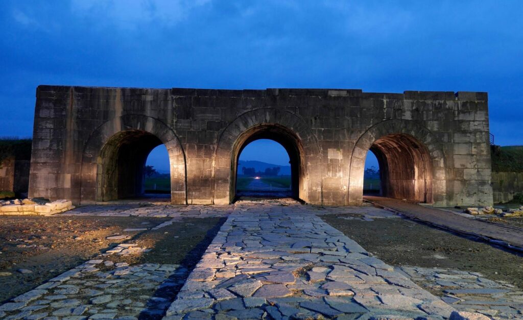
Ho Citadel – the capital city of Dai Ngu (the national name of Vietnam during the Ho Dynasty) was built in 1397. This stone citadel is recognized by UNESCO as a World Cultural Heritage Site and is one of the few remaining stone citadels in the world. Here, tourists can admire the majestic citadel entirely built of large stones, including slabs weighing more than two tons, and visit associated cultural sites like Don Son Mountain, Phuong Giai Village, etc.
3.2.2. Lam Kinh Historical Site
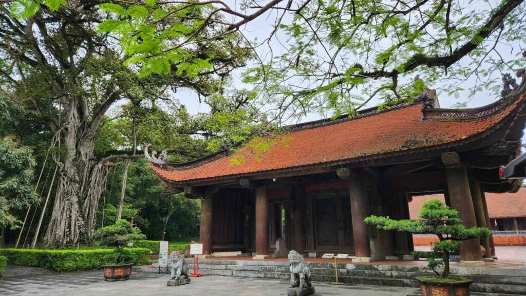
Lam Kinh Historical Site is the cradle of the Hau Le Dynasty in Vietnam. Built in 1428, it is famous for its architecture based on the feng shui theory of “leaning on mountains, facing waters.” This architectural complex is surrounded by various mountains and the Ngoc River, with temples, shrines, and tombs scattered around. Visiting Lam Kinh Historical Site will help history-loving tourists understand more about the feudal period of Vietnam.
3.2.3. Thai Temple of the Hau Le Dynasty

Another attraction on the Thanh Hoa map that history enthusiasts cannot miss out on is the Thai Temple of the Hau Le Dynasty. This place worships 27 emperors of the dynasty, including the two national heroes Nguyen Trai and Le Lai. To this day, Thai Mieu Temple still preserves many valuable artifacts. In addition to learning about history, tourists can also explore the ancient architecture and typical sculptures of the Hau Le Dynasty.
3.2.4. Ham Rong Historical and Cultural Relic Site
Ham Rong is a relic site from the resistance war against the United States. It includes many scenic spots, historical sites, and cultural structures such as Ham Rong Bridge, Ham Rong Mountain, Tien Son Cave, Ngoc Mountain, Dong Son Ancient Village, and Truc Lam Ham Rong Monastery. This is a must-visit tourist destination on the Thanh Hoa map.
4. Must-eats on the culinary Thanh Hoa map
Visiting Thanh Hoa Vietnam, don’t miss out on these local specialties:
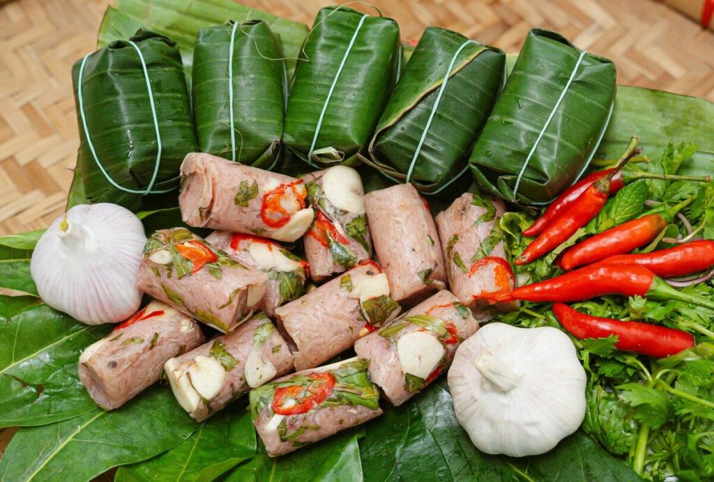
- Fermented pork rolls: This is Thanh Hoa’s most famous specialty with a slightly sweet, spicy, and sour taste.
- Shrimp rolls: This is another traditional dish of Thanh Hoa with an aromatic flavor.
- Shrimp pancake: This dish has a crispy rice flour crust filled with fresh vegetables and shrimps.
- Steamed rolled rice pancake: This dish has a soft texture, often served with fried shallots and fish sauce.
- Nga Son rice-paddy eel salad: This dish is made from the firm flesh of rice-paddy eels and dipped in a special sauce made from those eels also.
- Banh rang bua: Made from steamed rice flour crust, pork, and wood ear mushrooms, this dish brings a sweet and fatty taste.
- Banh gai: This is a rustic dish with a black outer layer, along with a soft and sticky texture blended with sugar, mung beans, and grated coconut.
The Thanh Hoa map serves as an indispensable companion for anyone exploring the diverse wonders of Thanh Hoa. Whether discovering the pristine beauty of beaches, unraveling the rich tapestry of historical sites, or indulging in local delights, the Thanh Hoa map is your trusted guide.
Don’t hesitate to pack your luggage, come and discover the amazing land. For more information please visit our family website:
- For Vietnam online visa Govietnamvisa.com
- For Vietnam local tours: Govietnamtourist.com

